




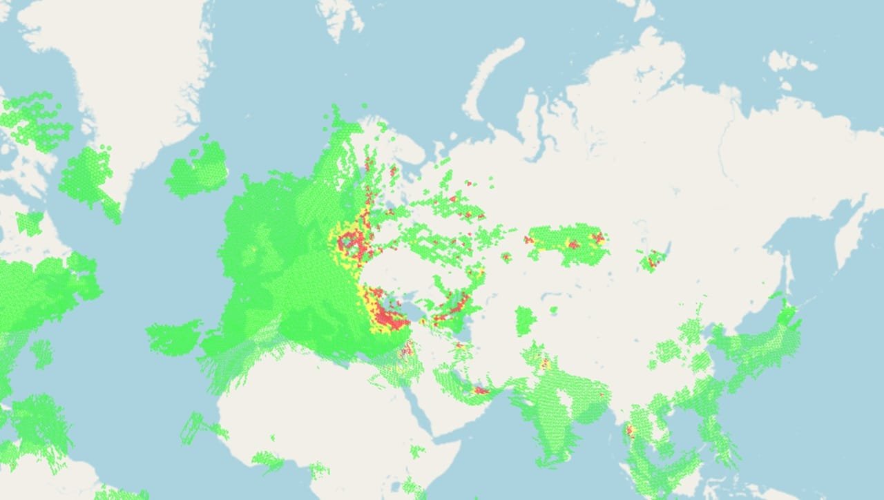
As interference with Global Navigation Satellite Systems (GNSS) grows in both scale and frequency, navigation specialists are warning that ships and crews are being exposed to increasingly unacceptable risks while continuing to support the supply chains underpinning global trade.
The rapid expansion of powerful radio signals capable of overwhelming GNSS and global positioning systems known as jamming is being accompanied by the spread of false data designed to deceive onboard systems into displaying an incorrect position, a technique known as spoofing.
The problem is particularly acute in strategically important maritime chokepoints. Among the areas most affected are the Strait of Hormuz, at the western end of the Arabian Gulf, and the Bab Al Mandab Strait, in the southern Red Sea. Together, these two critical waterways accounted for the overwhelming majority of reported incidents during the first six months of this year.
But interference is not limited to those locations. Other areas of concern include the Baltic Sea, the Black Sea, Russian energy export terminals, the eastern Mediterranean and waters off South America.
A Master Mariner told Seatrade Maritime News that recent conflicts disrupting established trade routes have exposed the vulnerabilities and weaknesses of GNSS with growing clarity. Despite these risks, merchant ships continue to operate through affected waters.
According to the Master Mariner, some prudent shipowners and operators whose vessels and crews face exposure are already considering, or have adopted, fail-safe backup technologies. One of the systems being examined is enhanced long-range navigation, or eLoran.
Unlike satellite-based navigation, eLoran relies on powerful transmitters located on the ground. The low-frequency technology can transmit signals over long distances, allowing receivers, including navigation equipment aboard ships, to use signals from two or more separate locations to determine an accurate position.
eLoran signals are considerably more powerful than GPS and are difficult to block, jam or spoof. Its positioning accuracy is measured in metres and typically falls within a range of eight to ten metres.
The system also has an established track record and is already widely used in critical infrastructure sectors, including communications, power grids, financial networks, data centres, as well as military and defence applications.
Earlier this year, Richard Bell, a navigation expert with the UK’s Maritime and Coastguard Agency, submitted a proposal to the International Maritime Organization (IMO) highlighting what he described as the “compelling need for a terrestrial complement to GNSS”.
Bell identified eLoran as the most viable technology because it is mature, proven and relatively inexpensive, with networks already in place or under development. However, he stressed that the benefits can only be realised if ships are equipped with eLoran receivers.
He also proposed that the installation of such equipment should become mandatory, a measure that would require action at the IMO.
The UK is already investing in the technology. In November last year, the government announced a GBP155 million investment in its eLoran programme, designed to provide positioning, navigation and timing (PNT) services across land, air and sea.
The system is intended to be highly resistant to jamming and spoofing and entirely independent of satellite signals. The programme will also include a GNSS interference monitoring system capable of tracking threats to PNT signals and responding to them.
While governments and navigation authorities work on longer-term resilience measures, marine insurers are also taking a more proactive role.
Last week, P&I Club NorthStandard announced a partnership with SGM Technology, the maritime distributor of the PntGuard platform, which authenticates ship-position signals in real time.
PntGuard is designed to address a similar problem to eLoran but uses Iridium low Earth orbit satellites to deliver a secure, encrypted signal feed that is approximately 1,000 times stronger than GPS, making it extremely difficult to block.
Commenting on the partnership, Alexander Wiik, Chief Commercial Officer at SGM Technology, said that PntGuard can identify a vessel’s true position when GNSS fails, helping maintain certainty, safety and control throughout a voyage.
Wiik also warned that GNSS interference is no longer restricted to active conflict zones. Spoofing and jamming are increasingly disrupting commercial shipping around the world, potentially sending ships off course and placing crews at risk.
The consequences, he said, extend well beyond immediate navigation problems. They can affect revenues, regulatory compliance and insurance, highlighting why reliable position verification is becoming increasingly important to the maritime sector.
By comparing a vessel’s GNSS feed with a fully authenticated signal, PntGuard is designed to provide immediate visual and audible alerts when GNSS fails, giving operators an additional layer of protection against manipulated or disrupted positioning data.