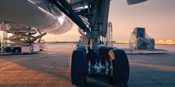

The temporary shutdown of airspace around El Paso earlier this year did more than interrupt flight operations. It highlighted a deeper vulnerability within modern aviation: the growing dependence on GPS-based systems at the very moment governments are turning to security tools that can interfere with them.
Airspace closures linked to security activity were once associated mainly with conflict zones. Increasingly, however, they are appearing in ordinary commercial corridors, exposing a difficult balance between national security measures and the uninterrupted movement of civil aviation.
For cargo airlines operating on tight schedules and thin margins, even brief disruptions can ripple quickly through supply chains. The El Paso case became especially significant because it appears to have revealed a broader contradiction in how aviation safety and security policy are evolving.
Drone activity along the US-Mexico border has been monitored for more than a decade. But according to Lisa Dyer of the GPS Innovation Alliance, the incident brought a larger structural issue into view: regulators continue to require airlines and operators to adopt increasingly advanced safety systems built around dependable satellite navigation and communications, while at the same time permitting security measures that may undermine those very systems.
Dyer argues that certain counter-drone technologies — including jamming, spoofing and directed energy tools — may neutralize aerial threats, but they can also interfere with positioning signals, airport systems and emergency communications well beyond the intended target area.
That matters deeply for air cargo. GPS is not simply a cockpit navigation aid. It underpins fuel-efficient routing, aircraft separation, communication timing, airport coordination and ground operations. When that signal is disrupted, aircraft can still operate safely through redundancy procedures, but the cost in efficiency can mount quickly.
According to Dyer, the consequences spread beyond the flight deck. Once GPS reliability is degraded, airport operations and logistics planning also begin to suffer. She warned that harmful and illegal interference to GPS and related systems is entirely preventable, yet the delays it causes can cascade rapidly through supply chains.
For cargo operators, the operational impact can be immediate: rerouting, higher fuel burn and added congestion at airports that are already operating under pressure. Those effects are especially serious for time-sensitive cargo, including pharmaceuticals, express shipments and humanitarian supplies, where delivery windows may be linked directly to patient care, production timelines or emergency response.
The concern is no longer theoretical. Aviation authorities in several regions are already reporting more frequent interference alerts. Industry data shows flights in Latin America have been affected, while regulators have also highlighted risks in parts of Eastern Europe and the Baltic. Notices to pilots warning of GPS or GNSS disruption are becoming more common, suggesting the issue may be shifting from episodic to systemic.
For logistics planners, this raises a broader challenge. Many of the reliability assumptions built into global supply chains now depend on technologies that can be disrupted by events far outside an airline’s control.
Large cargo hubs are particularly exposed. Because they function as synchronization points linking aircraft rotations, trucking schedules and warehouse throughput, interference affecting a single airport can spread quickly across wider networks.
The industry has already seen warning signs. GPS disruption around Dallas-Fort Worth International Airport forced flight rerouting for several days in 2022, generating significant operational costs for both passenger and cargo operators. Similar alerts have been issued around major hubs elsewhere, including repeated concerns near Delhi’s principal airport.
Even limited signal degradation can increase pilot-controller workload, slow arrivals and departures, and create downstream bottlenecks. For cargo carriers handling connecting freight, those delays can lead directly to missed onward transport links and congestion in storage areas.
Alternative navigation technologies are under development, including new satellite constellations using different spectrum bands. But integrating those systems into certified aviation operations will take time. Certification timelines are measured in years, not months. Until then, aviation remains overwhelmingly dependent on GPS infrastructure that was designed to be continuously available, even though localized interference — especially that linked to security operations — does not fit neatly into traditional reliability models.
Ultimately, the El Paso airspace closure raises a broader question for policymakers everywhere: how can states counter emerging drone threats without destabilizing critical infrastructure in the process?
Dyer believes blunt force approaches such as jamming and spoofing are not the answer. In her view, they risk creating new vulnerabilities while offering only limited long-term effectiveness against adversaries who can quickly adapt.
For cargo aviation, the stakes go well beyond operational inconvenience. Satellite navigation supports not just aircraft routing, but also communications timing, emergency coordination and airport safety systems. Disrupting it can have consequences far beyond aviation itself — and far beyond a single airport closure.